Saturday, July 24, 2010

The odds and ends

The trip leftovers:
  • The seven days from Baker City to Missoula covered just a little more than 430 miles. Definitely my highest mileage week ever.


  • final mileage

  • The 4 riders in the group totaled almost 1,200 miles during the seven days, and we did not suffer a single flat. This fact blows me away. I brought more spare tubes (5) than jerseys (3). Obviously, I was trying to anticipate bad roads and roadside debris. So I really feel lucky. Other than some routine maintenance, like chain lubing, tire inflating, and Allen bolt tightening, we did not need to do anything.


  • My biggest fear during the riding was an accident. It's not hard to fall off a bike. Happily, this didn't happen either.


  • Memo to Montana drivers -- You can take a few extra seconds to slow down and give us some space when you pass us. The guys with Idaho plates really kicked your ass in this regard.


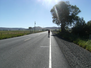
  • The route that we took this week was part of the ACA's Transamerica Route, and I cannot recommend it enough. The landscape features in this one-week stretch are astoundingly diverse -- I mentioned the rivers, but the sageland, forests, and mountains were amazing as well. And the riding is very challenging. If you are looking for a vigorous one-week tour that is lightly travelled and visually interesting, this is a great one. I would not turn down the opportunity to do it again.


  • How much does Delta suck? Well, it's cheaper and easier to have a Missoula bike shop box and ship my ride home than check it with the airline. And shipping my camping gear home is cheaper, too. I'm happy to spend my money with UPS or a bike shop instead of with Delta.

I appreciate the fact that people have been reading this. Thanks for hanging in there with us. See you soon.
See ya
- db

Friday, July 23, 2010

One last day, one last climb

Friday came with cool morning temperatures and the climb up Lolo Pass in the first 13 miles. Steve and I took off shortly after 8 and climbed steadily until about 9:30 when we topped out within a couple of minutes of each other. The first 8 miles were surprisingly mild, enough so that you could convince yourself that this wasn't going to be so hard. That's where my lifelong commitment to pessimism really came through for me. The meat of the climb -- the last five miles -- were steep and ugly. But there were no real surprises, and we were at the pass before anything stopped working.


(At the top.)


It was a tough one, especially after the six previous days. Lots of body parts ache. I will look like a collection of ice packs at work next week. Dad couldn't join us until a couple miles on the other side of the pass, as he's nursing some sore joints and fatigue. But we enjoyed the rest of the downhill into the town of Lolo.

After lunch in Lolo, we rode the remaining 8 miles into Missoula. After visiting the Adventure Cycling Association office, we had a great dinner, and then dropped off Aunt Wanda at the airport for her flight out. She did a great job for Dad for two weeks, and we really appreciated that.

Tomorrow's a rest day for the three continuing onward, and I'm sticking around to ship my bike home and help Dad with whatever he needs. I'll also probably post some random stuff that I haven't fit into any previous posts.

Then it's an early flight out on Sunday, a stop in SLC, and then to Boise, arriving shortly after noon. I'm very ready to be home.

Thursday, July 22, 2010

So much for conserving energy

I had this great plan for today. I was going to ride conservatively for the 66 miles from Lowell to Powell. I wanted to save energy for tomorrow's climb up Lolo Pass into Montana, and I thought I could do that over a very gradual ascent of 2,000 feet.

The route had other ideas. It was really hard to get into a rhythm with rolling terrain and yet another headwind. Seriously, isn't the wind conventionally supposed to blow west-to-east, south-to-north? Not happening this week. Feh. So I wheeled into the Lochsa Lodge in Powell at 3, burnt out and sore. Can't wait for tomorrow, eh?

On the plus side, the Lochsa is probably the prettiest river we've seen, and we've seen a different one every day this week. It's the most remote, too, and that probably helps its attraction. Regardless, it's very beautiful.


(Dad follows the Lochsa)

Tomorrow's climb, on my last day of riding, is the toughest. It will be the highest pass that I ride through, and the elevation profile is intimidating. But on the other side is Missoula, a great town that I'm looking forward to revisiting. And I'm really looking forward to a couple days off the bike, honestly. It kills me to say that, but my body is ready for rest.

Wednesday, July 21, 2010

Not bad, Trebek

Today started early, with a breakfast of mostly Goldfish crackers and almonds. Steve and I wanted to get a jump on White Bird Hill, so we skipped the hot breakfast and left before 7 a.m. It worked out well, as we made our way up 2,900 feet in 14 miles successfully. We were both at the top by 9:15 or so, and then decided, with Vicki, to descend into Riggins for an actual meal. We ate there and were soon joined by Wanda and Dad, who had ridden about half the hill before calling it good. Wanda shuttled him to the top, and he rode into town to join us.


(Not fun, but done.)


I really wish I could adequately describe how relieved and surprised I was that we were able to get up that hill in such good time. Since the earlier hills had caused so much trouble, and since this looked a great deal more difficult, I really was expecting the worst. Instead, we managed a nice steady climb with virtually no traffic. Amazing.

We left Riggins and the mess that is Highway 95 for Highway 13, which meanders along the South Fork of the Clearwater until it hits Kooskia. We then switched to Highway 12, which brought us here, to Lowell, along the Lochsa River. (The folks from Kansas have seen so many different rivers in the last few days that they are having a hard time keeping them straight.) It was our longest day -- 71 miles. Tomorrow we have 66 miles over which we'll gain another 2,000 feet or so. Let's hope it goes as well as today did.

Tuesday, July 20, 2010

Downhill to the Salmon River

Crisp, cold morning today as we set out from New Meadows up Highway 95. We had to wear jackets/vests, hats, full-fingered gloves, etc., with temperatures in the 40s.


(Cold gear!)


After a few miles of rolling road, our route came alongside the Little Salmon River, and both river and road headed consistently downhill. Except for one section in a canyon that had no shoulder and patchy pavement, the next 15 miles or so was amazing. The best of the week. We got to Riggins by 10:30 and soon sat down to an early lunch.


After that, though, we were back to familiar elements: rolling terrain with a hot headwind. We really slowed down. Thanks to the great start, and crossing over into Pacific time, we still reached White Bird by 2 p.m. after 65 miles.


The bad news was when we drove to Grangeville for dinner (as suggested by the locals). We saw tomorrow's ugly climb -- White Bird Hill. On Highway 95, it's listed as 8 miles of 7 percent grade. We are opting for OLD Hwy 95, which will add almost 4 miles, but hopefully will also feature a less demonic pitch.


We'll see. Not gonna be easy to sleep tonight...

Monday, July 19, 2010

Slow and steady into New Meadows

Monday's ride was an interesting one. (Steve and Vicki drove to our destination, New Meadows, to ride around that area so that they could enjoy some time on their tandem.) Dad and I rolled out of Cambridge around 8 and basically started out on rolling terrain that gradually gained us elevation. We had a few long hills, but the incline was small enough that we didn't have to stop.


(Up we go.)


That changed after a break in Council. We left there, and after 4 or 5 miles found ourselves at the foot of Fort Hall Hill (a local in Council had warned us about it). It wasn't even marked on the ACA map, a fact that I might alert them to when we get to Missoula.

We probably spent 2 hours going up 6 miles. Truck traffic on Highway 95 is pretty intense, and there was very little shoulder to speak of (see the Flickr photos). So it was really draining mentally, too.

After cresting that hill, it was back to the rolling stuff, although this time it was through forested highway, so at least we had some shade. We reached New Meadows around 2:30.

Another tough day, but I think Dad and I were at least pacing ourselves so that we both could get through the ride. We'll see what Tuesday brings.

Rewinding...

Note: The Flickr photo page is set up. See the link on the righthand frame.

Well, they're all long days, aren't they?

So let's recap yesterday. Today's ride will be the next post.

Sunday started sunny and warm. We started later than expected, around 9, and that worked against us later. Dad and I made our way down to Oxbow Dam in good time, and then the heat hit as we climbed above it in a short, steep ascent. We quickly descended the other side of the hill, and then followed the Snake River to Brownlee Dam, where we crossed into Idaho.


(Dad + Steve)


We then climbed above the dam, and then followed the rolling road along Brownlee Reservoir until the day's toughest climb began as the road left the reservoir and climbed to an unnamed (on the map,anyway) summit at 4,100 feet. It was a long, slow, hot slog. Seven miles, 2,000 feet in elevation, very little shade (it's high desert), and no wind. Ouch. I'm pretty sure my body will suffer for that one for the rest of the trip.

We enjoyed the descent of 18 miles or so down into Cambridge, and set up camp in a city park. We paid for showers at the hotel that Wanda was staying in, enjoyed dinner in a local cafe, and turned in fairly soon afterwards.

Sunday, July 18, 2010

Something's got to change

Uh, so, right.

I'm very tired after today's 56-mile ride. It was the 7-mile climb out of Brownlee that really ruined it for us. So it's already 8 p.m. here, and I haven't loaded my photos yet. Or written this post. Late start = late finish.

So what I think is best for all of us is that I come back to this tomorrow, after our shortest ride of the week. OK? Thanks for your understanding.

By the way, my plan now is to load fewer, if any, photos on here, because the Blogger software really enjoys not working. However, I have a Flickr account, and will provide a link to it once I get my cycling photos on there. I think this will work better (well, for me).

Saturday, July 17, 2010

Rhymes with 'Richland'

Well that was an interesting 55 miles.

Lots of sun today. Not much wind. Plenty of hills.

Our first climb was just a couple of miles north of Baker City. Flagstaff Hill rose gradually to about 3,600 feet, and the Oregon Trail Interpretive Center at the top of the hill above the road made it close to 4,000 feet.


(Not real!)

Nice place, interesting exhibits, and then we were off.

We rode for a ways along the Powder River, which ends up flowing into Brownlee Reservoir. When our route finally parted ways with the river, we were rewarded with what we thought was a long, hot climb before coasting a few miles more into Richland for lunch. Kind of a late lunch, which would work against us soon. (Yep, foreshadowing.)


(Planning meeting.)


Heading out of Richland, we encountered the Richland Grade. It turned out to be 3 to 4 miles with, at times, a 7 percent grade. It was not fun. I'd say it bitch-slapped us.


(Suck it, Oregon!)

So we coasted/limped into Halfway, OR, and will spend the night here. I'm pretty ready to sleep.

Friday, July 16, 2010

Baker City

It's almost time.

My friend Hendo picked me up in Boise and drove us to Baker City this afternoon. He headed out after we unloaded my gear for a campout somewhere in the Wallowa-Whitman National Forest.

Important travel note: most of Oregon is under construction.

I met up with Dad and the other group members, got myself settled in my room at the Oregon Trail Motel (nice people, they undercharged me), and then met the group to go get dinner.

Meet the gang:
  • Dad - retired and a longtime bicyclist. He originally wanted to bike across the country, but just could not work out the logistics.
  • Aunt Wanda - Dad's sister. She started driving with him a week ago, and will drive the support van to Missoula.
  • Steve and Vicki - friends of Dad's from Kansas who have ridden Bike Across Kansas (BAK) with him previously. They are riding with Dad for two weeks.
I'm anxious to get going, honestly. There are a couple hills tomorrow that promise to be challenging (I'm being nice here). So I'll feel better when we're under way.

Thursday, July 15, 2010

You're currently enjoying Disposa-blog 3000

For now, this is a web log about joining my father and some of his friends for a bike ride. It might turn into something else, someday. Or it might die a horrible, neglected death.

Dad started July 5 from Seaside, OR, and tonight is in Baker City, OR. I'm joining him tomorrow evening in Baker City. And then on Saturday, three or four of us, with two support vehicles, will take off toward the week's destination: Missoula, MT. That's where my trip will end, but Dad and company will continue for a couple more weeks to Sheridan, WY, as his endpoint.

Anyway, I'm hoping to post photos and brief descriptions during the week. But a lot of that will depend on wi-fi availability and my own energy levels. I have a feeling I'm going to be super tired a few times. Just so we understand each other.

I should post a link to the Adventure Cycling Association. Their route-finding and maps make trips like this possible. For a map of the route that we will be riding over the next week, click here. Fortunately for you, you cannot see the elevation profile for that stretch online. Unfortunately for me, I have the full ACA route map, which practically mocks you as it lays out the torture you must endure. A rare "pro" for illiteracy.

Fortunately for me, though, the ACA is headquartered in Missoula, so they've been able to help me figure out how to get my bike and gear back to Boise (short answer -- not Delta).

So that's the overview. Details, with user-friendly graphics, hopefully are in the near future.